
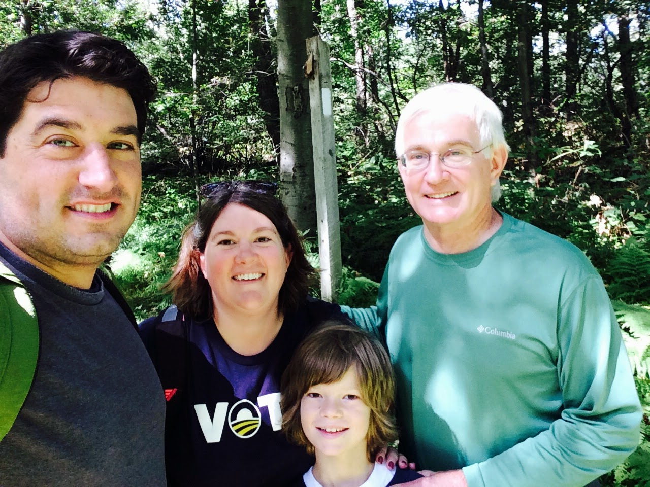
July 12-13, 2014
Tom, Shannon, Wyatt, Mike, Tobin and Rich (part)
17.3 miles
A few firsts for this trip. Our
first overnight hike. Tobin joined us
for the first time. And, the first trail
names conferred. But more on that later.
We began on Saturday. After Tobin arrived from outside Philadelphia, we met the Pittsburgh crew at the local Giant store to load up
on our rations for the 17 mile overnight hike that we had been delaying since
last year.
Starting at Swatara
Gap, we headed East towards Rt. 325.
Unfortunately, neck and back pain prevented Rich from joining us for
very long—so he headed back to my place.
On more than a few occasions over the next day we thought to ourselves,
and even said out loud, that he likely got the better deal!
The temperature was in the mid-80s, but the humidity made it feel
closer to 95 degrees as we began our first of several climbs up Sharp
Mountain. Because of these conditions, a thunderstorm was inevitable and it arrived about 1.5 hours into our
hike. In a clearing, Tobin set up a
make-shift tarp and we attempted to stay dry---but without much success. Shannon and Wyatt opted to sit outside the
tarp in their rain parkas and let the rain cool them off a bit.
This section of the Trail, heading towards Rausch Gap and Yellow
Springs, is known as St. Anthony’s Wilderness and it included a number of
populated settlements in the mid-to-late 19th century when coal
mines were in full production. The
Trail adjoins parts of old railroad and stagecoach routes, which seems
unfathomable given the rocky terrain that lasted the entire 17 mile duration.
Nestled between Sharp Mountain and Stony Mountain, the town of Rausch
Gap was once home to more than a 1000 residents. Today, all that remains are some foundations
and a cemetery with three known graves.
More info on the cemetery can be found here:
After a long and rocky six miles from our starting point, we arrived at the Rausch Gap Shelter to set up
camp for the night. Upon our arrival we
met a few thru-hikers who were also staying the night, and invited them to partake
of the dinner we could provide by being day hikers with too much food on our hands.
We first met and chatted with a hiker who called himself “Skunk Bite”, and soon
after we met “Sweet Tea” and “Moe”. All
three had left Springer Mountain, Georgia around the same time in late
March/early April, and were on schedule to make it to Maine by early October.
“Skunk Bite”, a graphic designer from California, appropriately was
given his trail name in Virginia when a skunk bit him as he slept. The bite—through his sleeping bag—required
him to take a week off of the Trail to get a full round of the rabies vaccine.
“Sweet Tea”, a Tennessee native who graduated from Dickinson College
last year, was so named because of the large amounts of that drink he liked to consume. “Moe”, a 67 year old retired school teacher from northern Wisconsin, took his name from the three stooges, because his golfing buddies are called Larry and Curly. Interestingly, all three were attempting to stay ahead of "the bubble"—the large group of hikers making their way north—because hikers in those numbers quickly fill up shelters
and camp areas.
As dusk settled in we gathered firewood and prepared dinner. Our menu of hot dogs and corn, with sides of cheese and
crackers, was enjoyed by us and our three new friends. It
was their second “Trail magic” of the day, as someone had provided them with a
hot breakfast that morning as they passed an intersecting road closer to
Peter’s Mountain.
Of course, dinner would not be complete without the Murphy tradition of
‘S’mores for dessert---with several packets of yummy Hershey’s chocolate bars
being consumed in no time at all. It was
a great way to end the day, and as the fire burned out, we said our goodnights
and went to bed.
Now, the Trail name. For
breakfast, Tom made pancakes. Really
good pancakes, in fact. They were
complimented by a tub of butter, and a large bottle of Giant brand syrup. Because I chose to lug that bottle of syrup
in my pack---a bottle much too large for our needs---the trail name “Syrup” was
thereby conferred upon me----my protest notwithstanding. For good measure, we named Wyatt “Little
Trooper” because it fits his energy and demeanor quite well. So, two of us now have names.
After breakfast, we were hiking by 9 a.m., and beating the heat. The 11 miles to Rt. 325 were more level than
the day before, and our packs were a bit lighter.
.JPG)
Along the way, we encountered another former mining village, and all
that remained of the abandoned town of Yellow Springs was a large clearing and
lots of rocks.
Nearby there was a sign
for “The General”, but we didn’t know what it was, so we didn’t take the side
trail to go find out.
Later research
shows that it’s a large steam engine piece of equipment, probably used for
mining in the days when lots of people and industry populated these desolate woods.

There were many hikers out on the Trail on both days, and on Sunday
there were a number of “Trail runners” who were running about 30 miles from
Clarks Ferry to an area near Swatara Gap.
Their pursuit of this challenge left us in awe of the stamina and
motivation it required.
After a few more inclines, we made the steady 1000 foot descent to Rt.
325, and the stream which Tom and Wyatt found refreshing after a long day on
the Trail.
With the two-mile segment still to make up, we are otherwise nearing
Hawk Mountain and looking forward to the northeast portion of the Trail.
Storms, heat, humidity and endless rocks notwithstanding, it was an
enjoyable two days with friends—new and old.
.JPG) Our 16th section hike on the Appalachian Trail, and perhaps
the nicest day of hiking we have experienced yet. If you put aside the fact that most of the 7
miles was spent walking over rocks, it might have been considered the perfect
hike all around.
Our 16th section hike on the Appalachian Trail, and perhaps
the nicest day of hiking we have experienced yet. If you put aside the fact that most of the 7
miles was spent walking over rocks, it might have been considered the perfect
hike all around.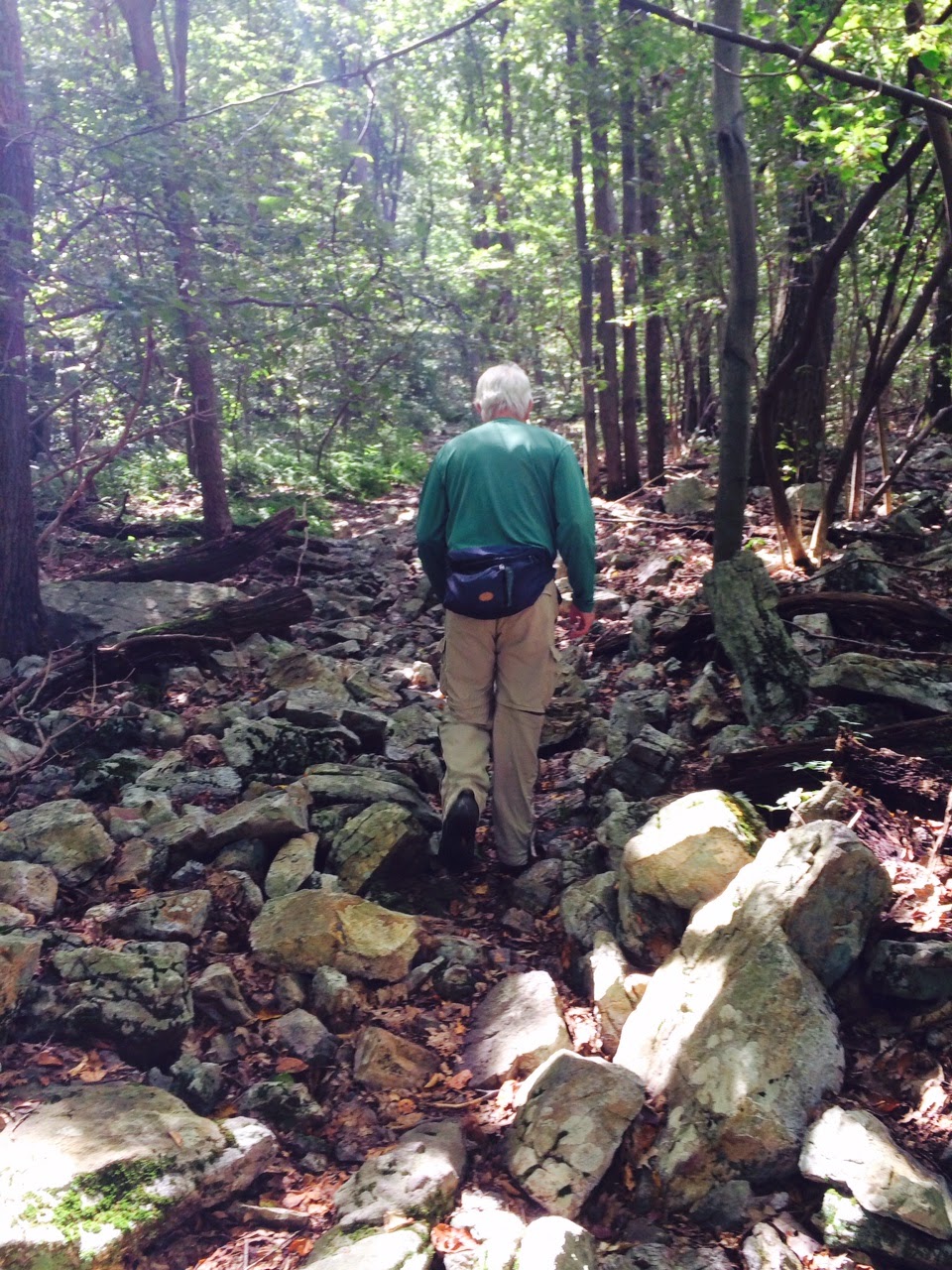.JPG) Heading along Blue Mountain towards Port Clinton, we began on Old Stage
Coach Trail, which is accessed about 1.5 miles from the nearest parking
lot. Of course, we don’t add this mileage
to our total, but it should be noted that not every hike can begin in a convenient
location. Thanks to Mona, though, we
were dropped off and picked up with one car—eliminating the need for two
cars---and saving lots of time. Great to have her join us again!
Heading along Blue Mountain towards Port Clinton, we began on Old Stage
Coach Trail, which is accessed about 1.5 miles from the nearest parking
lot. Of course, we don’t add this mileage
to our total, but it should be noted that not every hike can begin in a convenient
location. Thanks to Mona, though, we
were dropped off and picked up with one car—eliminating the need for two
cars---and saving lots of time. Great to have her join us again!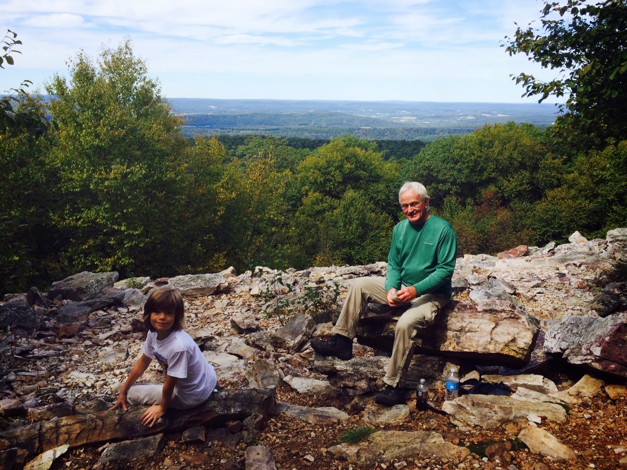.JPG) About three miles into the hike we stopped at the Auburn Overlook,
which is at 1500 feet and has incredible views of the valley below, the
Schuylkill River, and the town of Auburn in the far distance.
About three miles into the hike we stopped at the Auburn Overlook,
which is at 1500 feet and has incredible views of the valley below, the
Schuylkill River, and the town of Auburn in the far distance.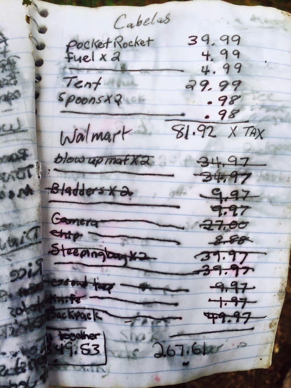.JPG) After the lookout, the Trail begins to descend, and drops 1000 feet in under
one mile. Managing this downhill, with the
rocks included, makes it easy to understand why Tom prefers going uphill. Explaining the rocks, and the quick descent doesn't quite do it justice--you must get out there and see for yourself.
After the lookout, the Trail begins to descend, and drops 1000 feet in under
one mile. Managing this downhill, with the
rocks included, makes it easy to understand why Tom prefers going uphill. Explaining the rocks, and the quick descent doesn't quite do it justice--you must get out there and see for yourself..JPG)
.JPG)
.JPG)


.JPG)